


PawPrint.net Forum
Thread #172
|
by: gerry June 17th, 2004 |
Alaska is too Short
Alaska has been short-changed! The most Westerly tip of the Aluetian Islands (Alaska side)was not entered into the map. The island of Attu was where the Japanese actually invaded the U.S. in 1942. The attached picture shows where Eareckson Air station on Shemya Island should be (52.42-44.19N/174.06-49.03E). The half dozen islands that make up the Near Islands have a unique distinction: dependent on how you look at them, they are either the most western tip of the U.S. by way of time zone, or the most easterly by way of coordinates.
Will the accuracy of the map be improved upon in the near future? Gerry 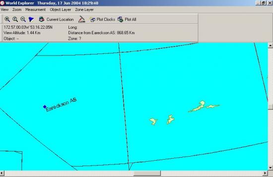
|
| RSS feed | Feed Description |
|---|---|
| Complete RSS feed | |
| RSS feed for: WorldTime Support | |
| A Rich Site Summary (RSS) feed is an xml data file that provides a summary of the information contained here. It is not designed to be viewed in your browser, but instead by rss reader software. If you do not know what this means - you can safely ignore it, as it is provided for advanced users with rss reader software only. | |
i
To contribute to our forums you must login. New members can register for a user account.